
Having great references for students to access can really spark their interest. I like to have a two or
three quality reference books on display, but not too many that the children are overwhelmed. Plus you want to encourage their desire for further research at the library.

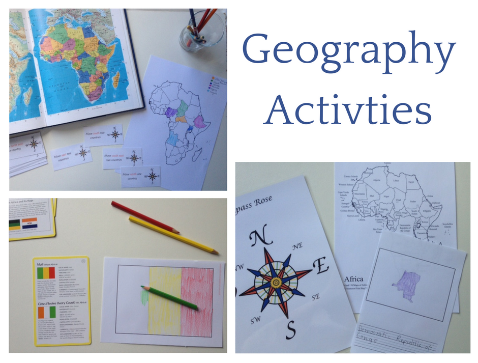
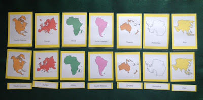
Learning About Continents
For younger children - globes, maps and cards are essential for hands on exploration and understanding. Older students are equally interested in real maps and globes, lending themselves to learning opportunities such as longitude and latitude, finding coordinates,You can find a tutorial for a no-sew felt continent map HERE, Check it out, it is awesome (scroll down for English translation).
You can find some free continent cards HERE.
For older children - continental plates and drift theory which I will talk about some more in an upcoming geology post.
Learning About Countries

Inspired by this post I took the idea to the next level by including the ordinal points of the compass as well as the cardinal. I loved the idea of using a map to help cement the concepts of the points of the compass and using it as a unifying activity. The children can really extend their knowledge with this activity and it can be modified to suit various ages.
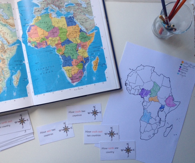
The other thing I like about this activity as it incorporates using reference books (primarily an atlas, but if their interest is piqued hopefully other resources as well). The extra cards in the set relating to mountains, rivers and capitals are great for older children to practice and hone their research skills.
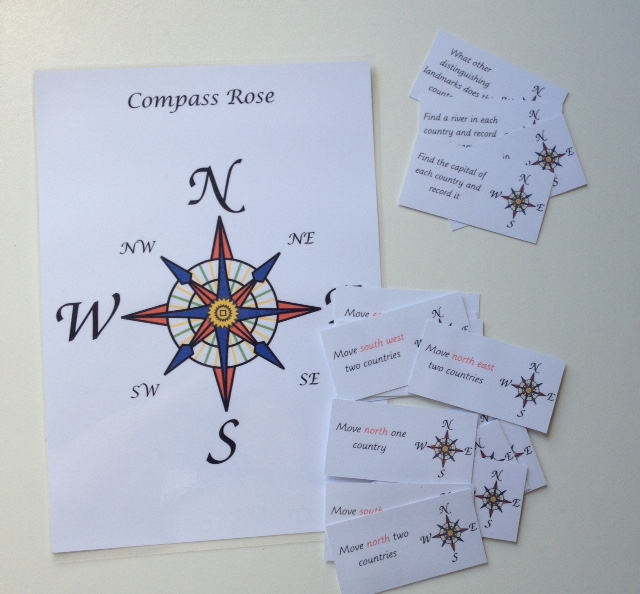
Find the compass rose and activity cards for free HERE.

There are a quite a few places to find free black-line maps but for easy reference you can visit HERE to find a collection of blank continent maps.
Learning About Flags
Parts of a flag - I think this work provides a a good foundation for building the child's knowledge. Introducing children to vexillology will give them an understanding of the design features, symbology and function of flags.Flags of countries - for younger students drawing the flags of other countries can be a good exercise for developing pencil skills, and it can be an early platform for research.

One activity many of my new elementary students enjoy is copying different flags of the world. This will often lead them to ask where each country is on a map and open many lines of inquiry - leading into history, geographic politics and economics.

I have a free template file HERE with blank fields as well as sheets with drawing and writing space for recording flags.
No comments:
Post a Comment